Port Alberni’s backyard has perfect boredom-busting hikes by Ellie Hadley
New to the area? Don’t worry, there are some fabulous local guides to help you find your way. West Coast Edge ATV Tours will happily take you on a thrilling cross-country trip helping you discover new landscape and great views. If you’d like to hike or bike while meeting new people check out the Alberni Valley Outdoors club or Alberni Valley Riders cycling club. Both groups are enthusiastic about our region and will point you to the best trails or bring you along on the next group adventure. Whether you’re a beginner or experienced, it’s always more fun with a big group of people!
So, grab your boots, strap on your pack and let’s wander through our top five trail picks!
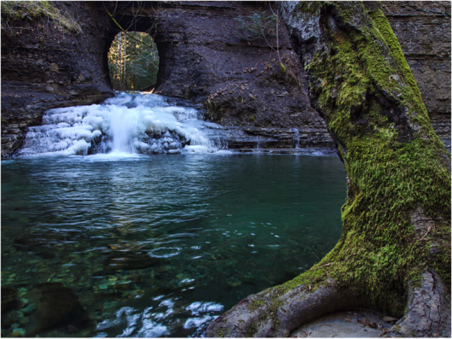
1. The Hole in the Wall
The easiest of our top five trails and excellent for families, this short trail takes you down to the banks of Rogers Creek to the “Hole in the Wall”. Once a best kept secret amongst locals, this fun trek can be followed up by a trip to Coombs Candy which sits close by the entrance to this trail.
Difficulty: Easy
Length: 25-minute round trip
Vehicle Access: 2WD
Elevation Gain: 34 m
Trailhead Coordinates: 49°15'.916, -124°44.756
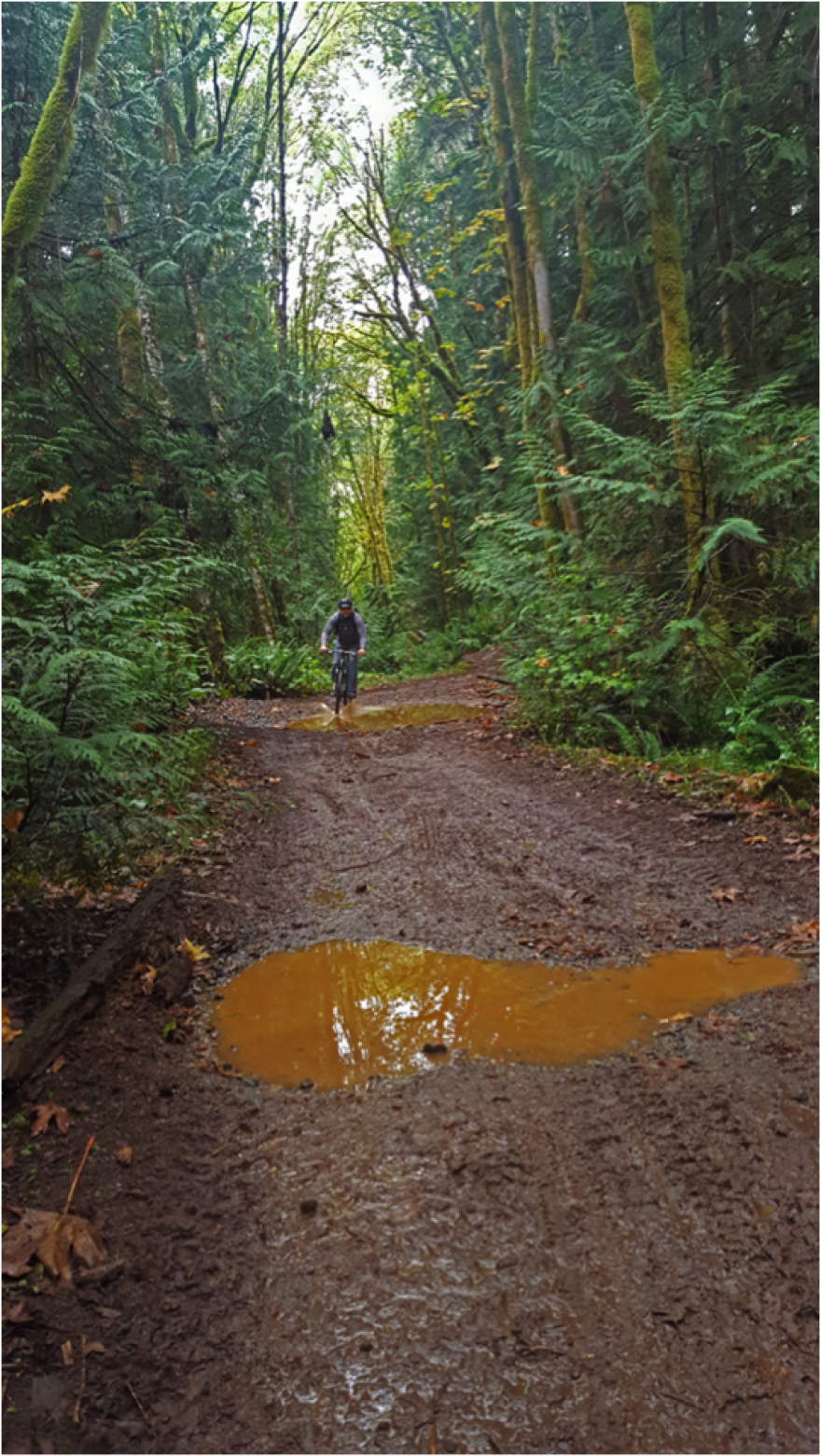
2. Log Train Trail
Another easy trail that features some local history! Our steam train and mill are famous landmarks in Port Alberni and the Log Train Trail follows a former logging road that closed in 1953. Great for cycling and horse riding as well as hiking, this is a fabulous day hike that the whole family can enjoy.
Riding a horse through this lush forest is a great way to cover more turf. While the horse does the hard work, you get to relax and enjoy the scenery. Contact the Westbrook Equestrian club (www.westbrookequestrian.com) who will match you with a suitable four-legged companion and guide you on this trail.
Difficulty: Easy
Length: 4-5 hours one way (22 km)
Vehicle Access: 2WD
Elevation Gain: Little
Trailhead Coordinates:
North End 49°23.470'N, 124°56.861'W | South End 49°16.001'N, 124°44.767'W
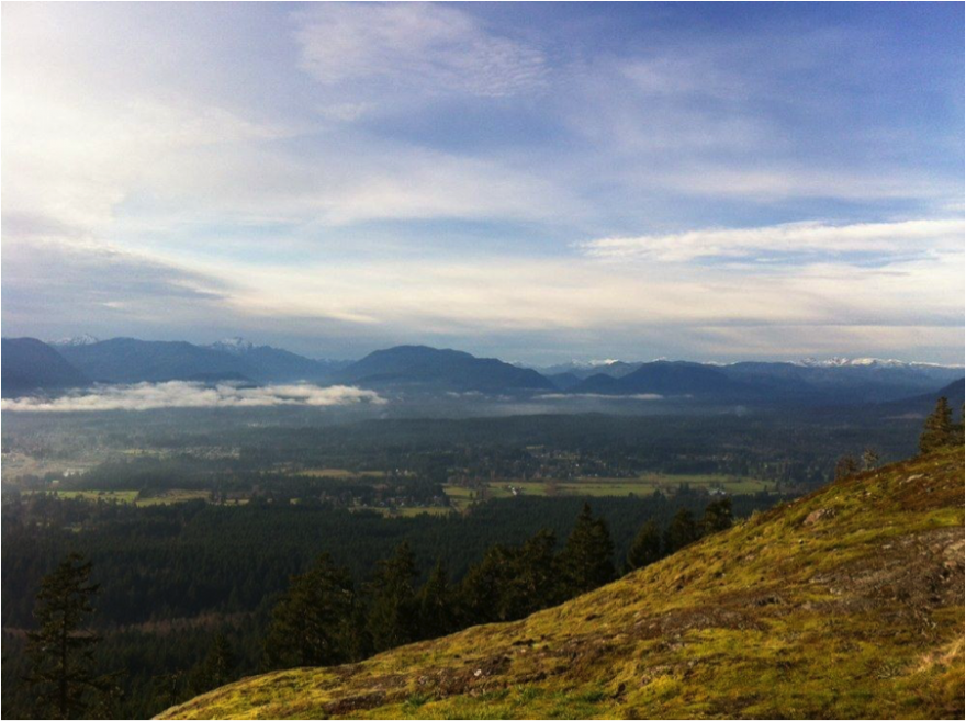
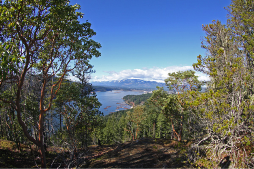
3. The Lookout
Named for the infamous viewpoint at the top, this trail is an easy-to-moderate hike to start with. The trail is well marked, dog/horse friendly and popular (helpful if you should happen to get lost) with lots of great places to stop and take a breather along the way. Enjoy a picnic at the top and enjoy the stunning views of the town below.
Difficulty: Medium
Length: 1-2 hours one way (3.9 km)
Vehicle Access: 4WD
Elevation Gain: 130m
Trailhead Coordinates: Near Coombs Country Candy off Highway 4
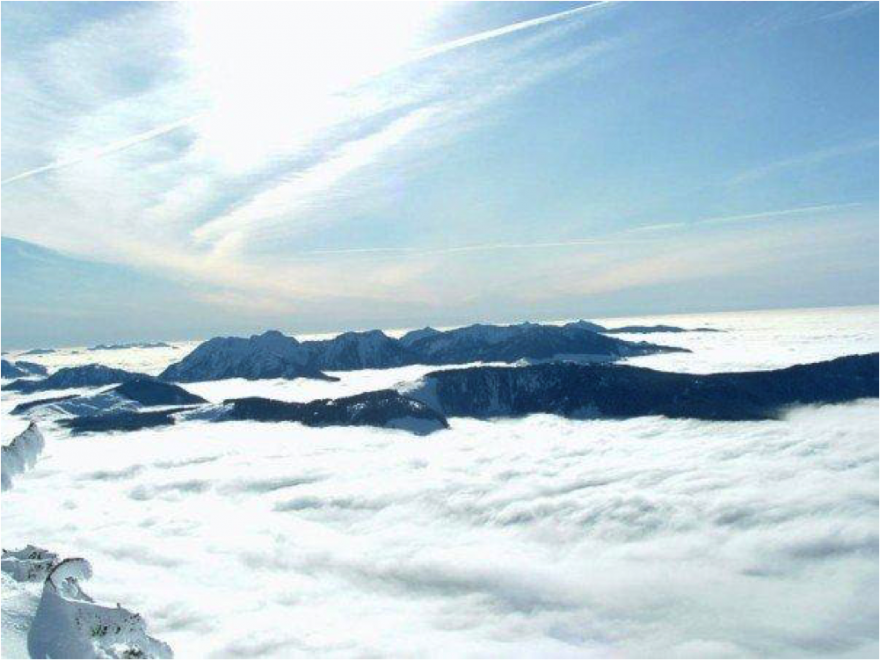
4. Judge’s Route (Mount Arrowsmith)
This one’s a bit trickier and a bit of a grind to the summit but it rewards the experienced hiker with stunning views. This trail takes you to the summit of the highest mountain in Southern Vancouver Island (1819metres)! Make sure to pack a lunch as this trail will take about 5 hours to complete and may require snowshoes and crampons in winter.
Difficulty: Difficult
Length: 6 hours round trip (5.8 km)
Vehicle Access: 2WD with high clearance
Elevation Gain: 1050 m
Trailhead Coordinates: N 9°12'58.6800" W 124°36'26.6400"
5. Alberni Inlet Trail
Discover the other side of the Alberni Valley with the Alberni Inlet Trail! Located on the traditional territory of the Nuu-chah-Nulth people; you can find amazing views of all our famous landmarks and diverse landscape to allow hikers of all abilities a chance to enjoy our countryside. Make sure to be prepared for this hike as it can be a long, tiring day and is best for moderate to experienced hikers.
Difficulty: Moderate
Length: 6 hours one way (12 km)
Vehicle Access: 2WD
Elevation Gain: 300 m
Trailhead Coordinates: 49°12'54.9717", -124°47'36.4552"
Special Mention: Canada’s tallest waterfalls - Della Falls
A great trip for experienced hikers is an adventure to Della Falls – the highest falls in Canada and at 440 metres (1456 feet) one of the highest falls in North America! Take the Della Falls Water Taxi (find them on Facebook) to start the 15km hike to Love Lake. Don’t forget your camping gear. There are a few spots you’ll want to extend the journey at.
For more information about this hike visit: http://www.trailsbc.ca/loop/vancouver-island/hike-della-falls-30-km
Which one will you tackle first?
Make sure to tag #exploreportalberni in your photos so we can see the views you discover on your visit!
Finding the trailheads can be tricky. You can find more in-depth information about local trails and directions at one of the many locally run Trail websites here:
www.portalberni.ca/trail-information
- 361 reads